One of my goals for 2019 is to improve my existing pages. This week I improved the island map section of my noise-based map generation page.
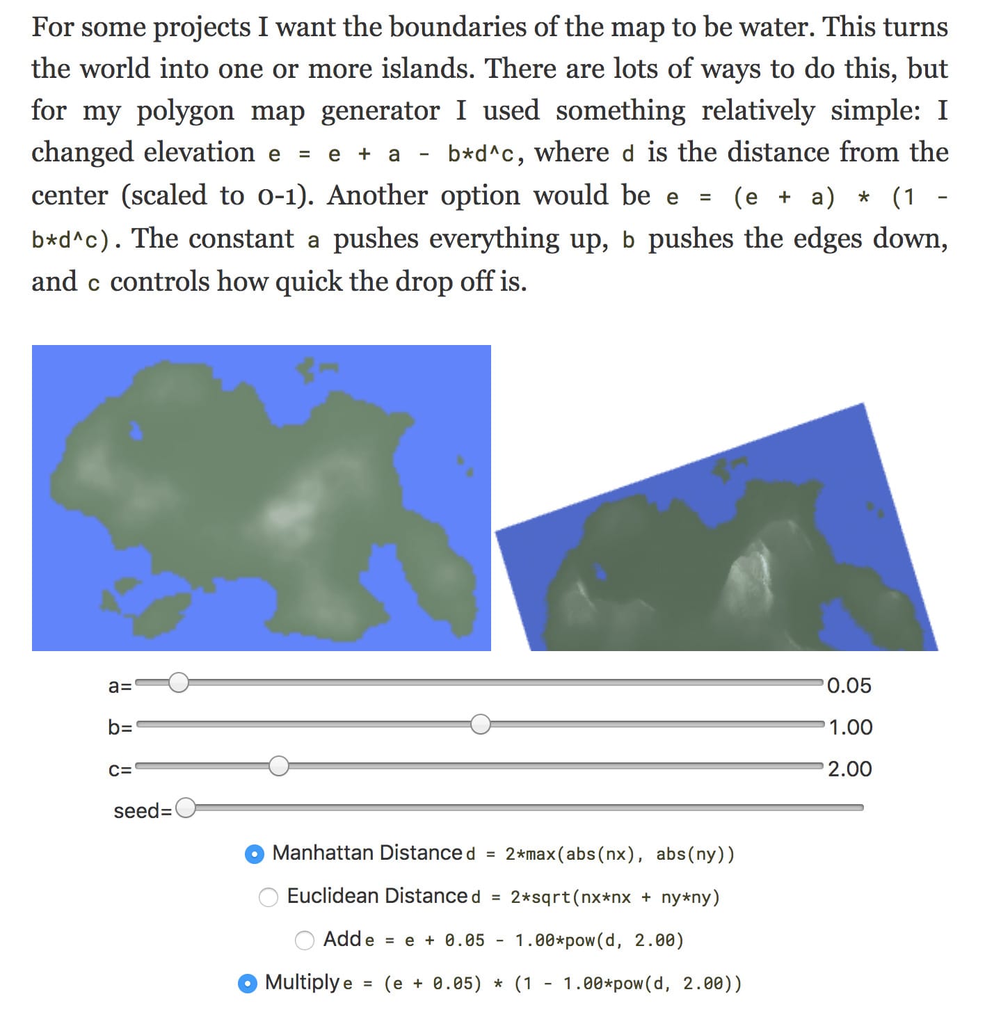
I had offered lots of options: additive vs multiplicative, Euclidean vs Manhattan distance, and three mysterious parameters named a, b, c. It was simple for me to offer lots of options. The problem with lots of options is that there's a large “possibility space” to explore. You may or may not find something you like.
Based on feedback from readers, I decided to rewrite this section. I stepped back and thought about why we're adding and multiplying. What is the goal? How does it work?
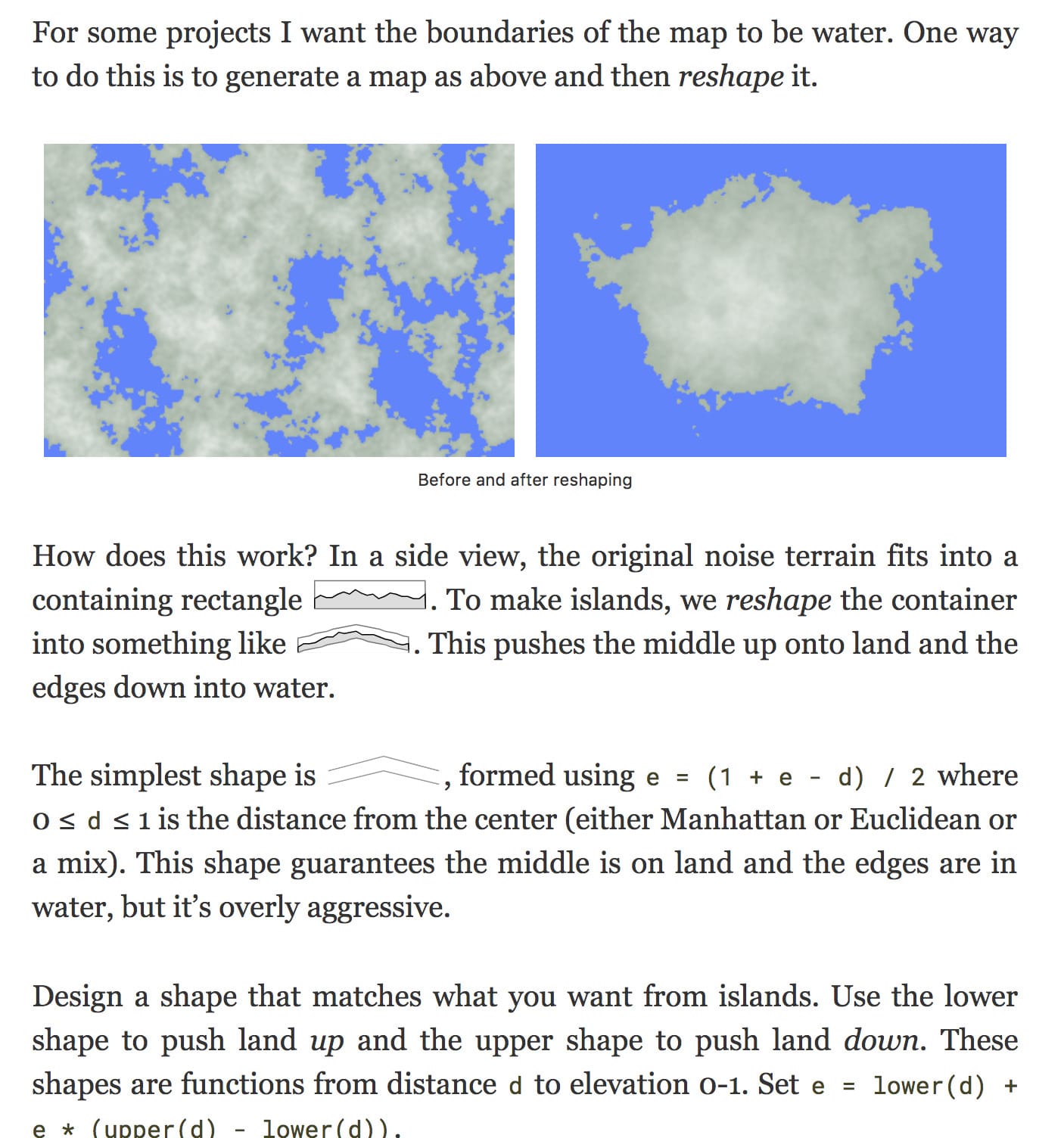
- Push the edges of the map down into water. I need to decrease elevations near the edges.
- Push the middle of the map up onto land. I need to increase elevations near the middle.
The main idea is to start with noise-based elevation and reshape it into what we want. The noise-based elevation fits into a box , and we reshape the box into something like . The contents of the box, whatever terrain had been generated, will get pushed up and down when the box is changed.
I rewrote the entire section of the page to explain this idea, and I ended up removing the interactive diagram.
Related: Why Minimal Guidance During Instruction Does Not Work says that experts can use the interactive exploration to navigate the possibility space because they have already built up the intuition to know where to go. Novices on the other hand learn better with guidance.
Labels: maps
Post a Comment